
Lustrac topographic map
Interactive map
Click on the map to display elevation.
About this map
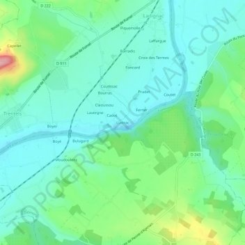
Name: Lustrac topographic map, elevation, terrain.
Average elevation: 91 m
Minimum elevation: 52 m
Maximum elevation: 205 m
Other topographic maps
Click on a map to view its topography, its elevation and its terrain.
Paille
France > Nouvelle-Aquitaine > Lot-et-Garonne > Trentels
Paille, Trentels, Villeneuve-sur-Lot, Lot-et-Garonne, Nouvelle-Aquitaine, France métropolitaine, 47140, France
Average elevation: 131 m