
Thank you for supporting this site ❤️
Make a donation
Make a donation
Nore topographic map
Click on the map to display elevation.
Thank you for supporting this site ❤️
Make a donation
Make a donation
About this map
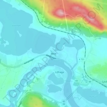
Name: Nore topographic map, elevation, terrain.
Location: Nore, Ljusdals kommun, Provinz Gävleborg, 827 30, Schweden (61.81966 16.03336 61.85966 16.07336)
Average elevation: 142 m
Minimum elevation: 119 m
Maximum elevation: 257 m
Thank you for supporting this site ❤️
Make a donation
Make a donation
Other topographic maps
Click on a map to view its topography, its elevation and its terrain.