
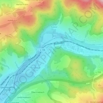
Schloß Ehreshoven topographic map
Interactive map
Click on the map to display elevation.
About this map
Name: Schloß Ehreshoven topographic map, elevation, terrain.
Average elevation: 174 m
Minimum elevation: 100 m
Maximum elevation: 315 m
Other topographic maps
Click on a map to view its topography, its elevation and its terrain.
Blumenau
Deutschland > Nordrhein-Westfalen > Engelskirchen > Feckelsberg > Blumenau
Blumenau, Feckelsberg, Engelskirchen, Oberbergischer Kreis, Nordrhein-Westfalen, 51766, Deutschland
Average elevation: 213 m