
Thank you for supporting this site ❤️
Make a donation
Make a donation
Apiary topographic map
Click on the map to display elevation.
Thank you for supporting this site ❤️
Make a donation
Make a donation
About this map
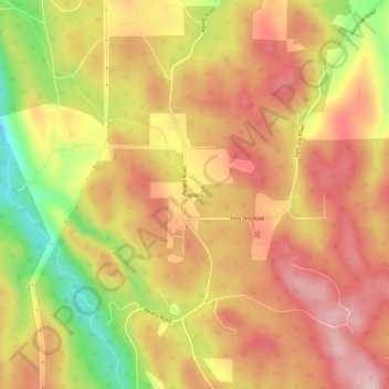
Name: Apiary topographic map, elevation, terrain.
Location: Apiary, Columbia County, Oregon, United States (45.99400 -123.05011 46.03400 -123.01011)
Average elevation: 287 m
Minimum elevation: 139 m
Maximum elevation: 381 m
Thank you for supporting this site ❤️
Make a donation
Make a donation
Other topographic maps
Click on a map to view its topography, its elevation and its terrain.