
Thank you for supporting this site ❤️
Make a donation
Make a donation
Kalk topographic map
Click on the map to display elevation.
Thank you for supporting this site ❤️
Make a donation
Make a donation
Kalk
801 Humboldt/Gremberg802 Kalk803 Vingst804 Höhenberg805 Ostheim806 Merheim807 Brück808 Rath/Heumar809 Neubrück
Thank you for supporting this site ❤️
Make a donation
Make a donation
About this map
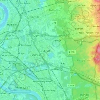
Name: Kalk topographic map, elevation, terrain.
Location: Kalk, Köln, Nordrhein-Westfalen, Deutschland (50.91004 6.98696 50.96214 7.14535)
Average elevation: 60 m
Minimum elevation: 36 m
Maximum elevation: 138 m
Thank you for supporting this site ❤️
Make a donation
Make a donation
Other topographic maps
Click on a map to view its topography, its elevation and its terrain.