
Weston topographic map
Interactive map
Click on the map to display elevation.
About this map
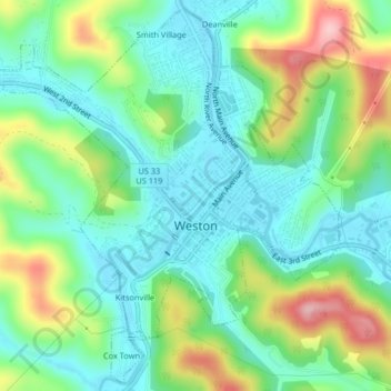
Name: Weston topographic map, elevation, terrain.
Location: Weston, Lewis County, West Virginia, 26452, United States (39.02562 -80.49314 39.05614 -80.45227)
Average elevation: 359 m
Minimum elevation: 304 m
Maximum elevation: 479 m
Other topographic maps
Click on a map to view its topography, its elevation and its terrain.
Jacksonville
United States > West Virginia > Lewis County
Jacksonville, Lewis County, West Virginia, United States
Average elevation: 364 m
Roanoke
United States > West Virginia > Lewis County
Roanoke, Lewis County, West Virginia, 26447, United States
Average elevation: 366 m