
Thank you for supporting this site ❤️
Make a donation
Make a donation
Comfort topographic map
Click on the map to display elevation.
Thank you for supporting this site ❤️
Make a donation
Make a donation
About this map
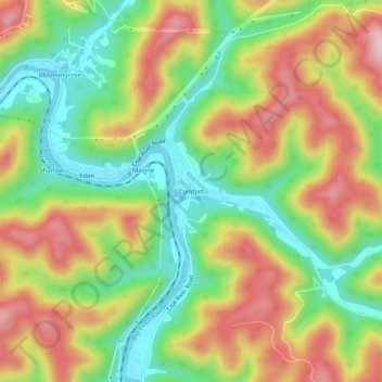
Name: Comfort topographic map, elevation, terrain.
Location: Comfort, Boone County, West Virginia, 25049, United States (38.11038 -81.63567 38.15038 -81.59567)
Average elevation: 331 m
Minimum elevation: 197 m
Maximum elevation: 487 m
Thank you for supporting this site ❤️
Make a donation
Make a donation
Other topographic maps
Click on a map to view its topography, its elevation and its terrain.