
Thank you for supporting this site ❤️
Make a donation
Make a donation
Peterson AFB Parade Grounds topographic map
Click on the map to display elevation.
Thank you for supporting this site ❤️
Make a donation
Make a donation
About this map
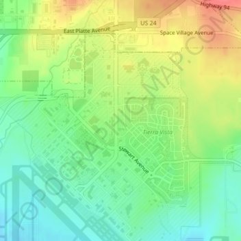
Name: Peterson AFB Parade Grounds topographic map, elevation, terrain.
Average elevation: 1,899 m
Minimum elevation: 1,872 m
Maximum elevation: 1,936 m
Thank you for supporting this site ❤️
Make a donation
Make a donation
Other topographic maps
Click on a map to view its topography, its elevation and its terrain.
Garden of the Gods
United States > Colorado > El Paso County > Colorado Springs
Average elevation: 1,970 m
Stratton Meadows
United States > Colorado > El Paso County > Colorado Springs
Average elevation: 1,819 m