
Thank you for supporting this site ❤️
Make a donation
Make a donation
Tomiño topographic map
Click on the map to display elevation.
Thank you for supporting this site ❤️
Make a donation
Make a donation
About this map
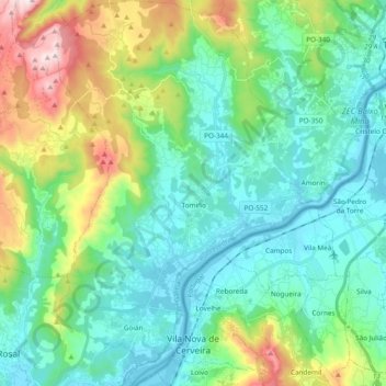
Name: Tomiño topographic map, elevation, terrain.
Location: Tomiño, Bajo Miño, Pontevedra, Galicia, España (41.92482 -8.81104 42.06641 -8.65723)
Average elevation: 159 m
Minimum elevation: 0 m
Maximum elevation: 645 m
Thank you for supporting this site ❤️
Make a donation
Make a donation