
Senden topographic map
Click on the map to display elevation.
About this map
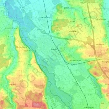
Name: Senden topographic map, elevation, terrain.
Location: Senden, Landkreis Neu-Ulm, Bavaria, 89250, Germany (48.29817 10.00917 48.34310 10.12480)
Average elevation: 505 m
Minimum elevation: 472 m
Maximum elevation: 562 m