
Thank you for supporting this site ❤️
Make a donation
Make a donation
Kargil tehsil topographic map
Click on the map to display elevation.
Thank you for supporting this site ❤️
Make a donation
Make a donation
About this map
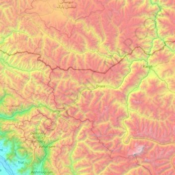
Name: Kargil tehsil topographic map, elevation, terrain.
Location: Kargil tehsil, Kargil district, Ladakh, 194103, India (34.09791 75.32697 34.74146 76.72019)
Average elevation: 4,005 m
Minimum elevation: 1,588 m
Maximum elevation: 7,057 m
Thank you for supporting this site ❤️
Make a donation
Make a donation