
Thank you for supporting this site ❤️
Make a donation
Make a donation
Uthausen topographic map
Click on the map to display elevation.
Thank you for supporting this site ❤️
Make a donation
Make a donation
About this map
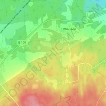
Name: Uthausen topographic map, elevation, terrain.
Location: Uthausen, Kemberg, Wittenberg, Sachsen-Anhalt, Deutschland (51.73732 12.52884 51.77586 12.57228)
Average elevation: 109 m
Minimum elevation: 68 m
Maximum elevation: 155 m
Thank you for supporting this site ❤️
Make a donation
Make a donation
Other topographic maps
Click on a map to view its topography, its elevation and its terrain.