
Thank you for supporting this site ❤️
Make a donation
Make a donation
Castelmonte topographic map
Click on the map to display elevation.
Thank you for supporting this site ❤️
Make a donation
Make a donation
About this map
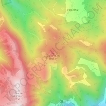
Name: Castelmonte topographic map, elevation, terrain.
Location: Castelmonte, Spoleto, Perugia, Umbria, 06049, Italia (42.70746 12.78280 42.70756 12.78290)
Average elevation: 862 m
Minimum elevation: 501 m
Maximum elevation: 1,152 m
Thank you for supporting this site ❤️
Make a donation
Make a donation