
Thank you for supporting this site ❤️
Make a donation
Make a donation
Crow topographic map
Click on the map to display elevation.
Thank you for supporting this site ❤️
Make a donation
Make a donation
About this map
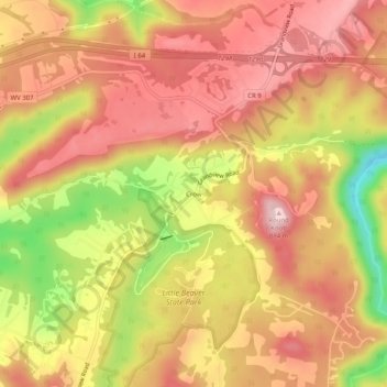
Name: Crow topographic map, elevation, terrain.
Location: Crow, Raleigh County, West Virginia, 25832, United States (37.73928 -81.09676 37.77928 -81.05676)
Average elevation: 792 m
Minimum elevation: 639 m
Maximum elevation: 880 m
Thank you for supporting this site ❤️
Make a donation
Make a donation
Other topographic maps
Click on a map to view its topography, its elevation and its terrain.
Thank you for supporting this site ❤️
Make a donation
Make a donation
Thank you for supporting this site ❤️
Make a donation
Make a donation