
Thank you for supporting this site ❤️
Make a donation
Make a donation
Glaze City topographic map
Click on the map to display elevation.
Thank you for supporting this site ❤️
Make a donation
Make a donation
About this map
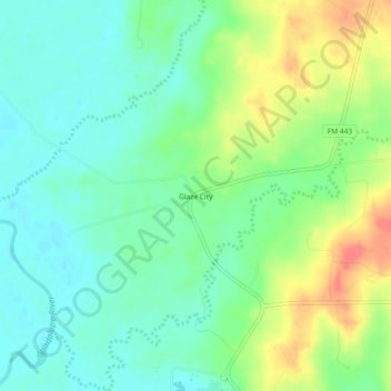
Name: Glaze City topographic map, elevation, terrain.
Location: Glaze City, Gonzales County, Texas, United States (29.38719 -97.30860 29.42719 -97.26860)
Average elevation: 86 m
Minimum elevation: 65 m
Maximum elevation: 123 m
Thank you for supporting this site ❤️
Make a donation
Make a donation
Other topographic maps
Click on a map to view its topography, its elevation and its terrain.