
Cap de la Ville topographic map
Interactive map
Click on the map to display elevation.
About this map
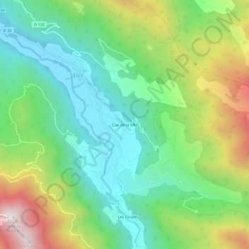
Name: Cap de la Ville topographic map, elevation, terrain.
Average elevation: 956 m
Minimum elevation: 601 m
Maximum elevation: 1,636 m
Other topographic maps
Click on a map to view its topography, its elevation and its terrain.
Les Escales
France > Occitanie > Ariège > Ercé
Les Escales, Ercé, Saint-Girons, Ariège, Occitanie, France métropolitaine, 09140, France
Average elevation: 993 m