
Caernarfon topographic map
Interactive map
Click on the map to display elevation.
About this map
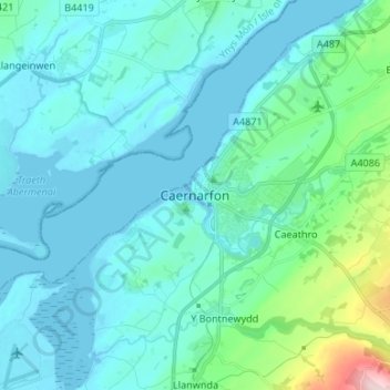
Name: Caernarfon topographic map, elevation, terrain.
Location: Caernarfon, Gwynedd, Wales, LL55 2AU, Verenigd Koninkrijk (53.09944 -4.31698 53.17944 -4.23698)
Average elevation: 37 m
Minimum elevation: -1 m
Maximum elevation: 283 m
Other topographic maps
Click on a map to view its topography, its elevation and its terrain.
Gwynedd
Verenigd Koninkrijk > Wales > Gwynedd
Gwynedd, Wales, Verenigd Koninkrijk
Average elevation: 199 m