
Thank you for supporting this site ❤️
Make a donation
Make a donation
Clatskanie topographic map
Click on the map to display elevation.
Thank you for supporting this site ❤️
Make a donation
Make a donation
About this map
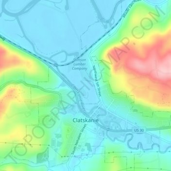
Name: Clatskanie topographic map, elevation, terrain.
Location: Clatskanie, Columbia County, Oregon, United States (46.09525 -123.22249 46.12351 -123.18318)
Average elevation: 46 m
Minimum elevation: -3 m
Maximum elevation: 170 m
Thank you for supporting this site ❤️
Make a donation
Make a donation
Other topographic maps
Click on a map to view its topography, its elevation and its terrain.