
Thank you for supporting this site ❤️
Make a donation
Make a donation
New Albany topographic map
Click on the map to display elevation.
Thank you for supporting this site ❤️
Make a donation
Make a donation
About this map
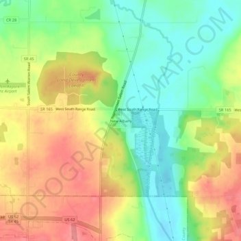
Name: New Albany topographic map, elevation, terrain.
Location: New Albany, Mahoning County, Ohio, United States (40.92228 -80.85592 40.96228 -80.81592)
Average elevation: 348 m
Minimum elevation: 308 m
Maximum elevation: 392 m
Thank you for supporting this site ❤️
Make a donation
Make a donation
Other topographic maps
Click on a map to view its topography, its elevation and its terrain.