
Thank you for supporting this site ❤️
Make a donation
Make a donation
Malacatán topographic map
Click on the map to display elevation.
Thank you for supporting this site ❤️
Make a donation
Make a donation
About this map
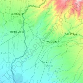
Name: Malacatán topographic map, elevation, terrain.
Location: Malacatán, San Marcos, 12015, Guatemala (14.78994 -92.18485 15.03108 -92.01415)
Average elevation: 441 m
Minimum elevation: 57 m
Maximum elevation: 2,033 m
Thank you for supporting this site ❤️
Make a donation
Make a donation