
Parada de Pinhão topographic map
Interactive map
Click on the map to display elevation.
About this map
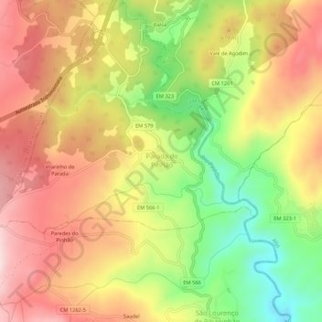
Name: Parada de Pinhão topographic map, elevation, terrain.
Location: Parada de Pinhão, Sabrosa, Vila Real, Portugal (41.31523 -7.60945 41.35523 -7.56945)
Average elevation: 630 m
Minimum elevation: 419 m
Maximum elevation: 808 m