
Thank you for supporting this site ❤️
Make a donation
Make a donation
Laksvatn topographic map
Click on the map to display elevation.
Thank you for supporting this site ❤️
Make a donation
Make a donation
About this map
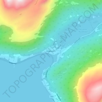
Name: Laksvatn topographic map, elevation, terrain.
Location: Laksvatn, Balsfjord, Troms og Finnmark, Norway (69.35622 19.34293 69.39622 19.38293)
Average elevation: 213 m
Minimum elevation: 0 m
Maximum elevation: 927 m
Thank you for supporting this site ❤️
Make a donation
Make a donation
Other topographic maps
Click on a map to view its topography, its elevation and its terrain.