
Farm Hill topographic map
Interactive map
Click on the map to display elevation.
About this map
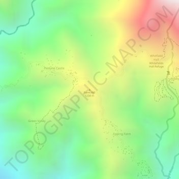
Name: Farm Hill topographic map, elevation, terrain.
Location: Farm Hill, Saint Thomas, Surrey County, Jamaica (18.04372 -76.62876 18.04382 -76.62866)
Average elevation: 1,022 m
Minimum elevation: 529 m
Maximum elevation: 1,692 m
Other topographic maps
Click on a map to view its topography, its elevation and its terrain.
Suffolk Park
Suffolk Park, Rowlandsfield, Saint Thomas, Surrey County, Jamaica
Average elevation: 145 m
River Head
River Head, Saint Thomas, Surrey County, Jamaica
Average elevation: 473 m
York
York, Seaforth, Saint Thomas, Surrey County, Jamaica
Average elevation: 120 m
Eleven Mile
Eleven Mile, Saint Thomas, Surrey County, Jamaica
Average elevation: 133 m
Morant Bay
Morant Bay, Saint Thomas, Surrey County, Jamaica
Average elevation: 23 m