
Thank you for supporting this site ❤️
Make a donation
Make a donation
Thunderbolt topographic map
Click on the map to display elevation.
Thank you for supporting this site ❤️
Make a donation
Make a donation
About this map
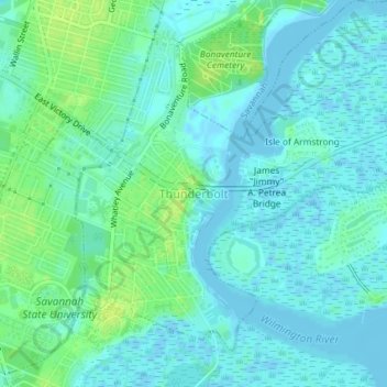
Name: Thunderbolt topographic map, elevation, terrain.
Location: Thunderbolt, Chatham County, Georgia, United States (32.02093 -81.06394 32.04606 -81.02741)
Average elevation: 5 m
Minimum elevation: -4 m
Maximum elevation: 14 m
Thank you for supporting this site ❤️
Make a donation
Make a donation
Other topographic maps
Click on a map to view its topography, its elevation and its terrain.
Thank you for supporting this site ❤️
Make a donation
Make a donation
Thank you for supporting this site ❤️
Make a donation
Make a donation
Thank you for supporting this site ❤️
Make a donation
Make a donation