
Thank you for supporting this site ❤️
Make a donation
Make a donation
Freeport topographic map
Click on the map to display elevation.
Thank you for supporting this site ❤️
Make a donation
Make a donation
About this map
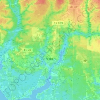
Name: Freeport topographic map, elevation, terrain.
Location: Freeport, Walton County, Florida, 32439, United States (30.45459 -86.19882 30.56015 -86.09054)
Average elevation: 14 m
Minimum elevation: -3 m
Maximum elevation: 42 m
Thank you for supporting this site ❤️
Make a donation
Make a donation
Other topographic maps
Click on a map to view its topography, its elevation and its terrain.