
Make a donation
Lyall Point topographic map
Click on the map to display elevation.
Make a donation
About this map
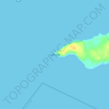
Name: Lyall Point topographic map, elevation, terrain.
Average elevation: 1 m
Minimum elevation: 0 m
Maximum elevation: 27 m
Make a donation
Other topographic maps
Click on a map to view its topography, its elevation and its terrain.
Ahousaht
Canada > British Columbia > Alberni-Clayoquot Regional District > Area C (Long Beach)
Average elevation: 14 m
Clayoquot Sound
Canada > British Columbia > Alberni-Clayoquot Regional District > Area C (Long Beach)
Average elevation: 101 m
Vargas Island
Canada > British Columbia > Alberni-Clayoquot Regional District > Area C (Long Beach)
Average elevation: 11 m
Escalante River
Canada > British Columbia > Alberni-Clayoquot Regional District > Area C (Long Beach)
Average elevation: 419 m
Make a donation
Hot Springs Cove
Canada > British Columbia > Alberni-Clayoquot Regional District > Area C (Long Beach)
Average elevation: 15 m
Barkley Sound
Canada > British Columbia > Alberni-Clayoquot Regional District > Area C (Long Beach)
Average elevation: 1 m