
Thank you for supporting this site ❤️
Make a donation
Make a donation
Underwood topographic map
Click on the map to display elevation.
Thank you for supporting this site ❤️
Make a donation
Make a donation
About this map
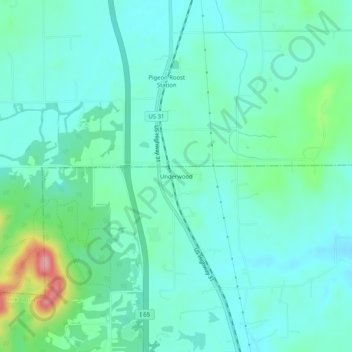
Name: Underwood topographic map, elevation, terrain.
Location: Underwood, Clark County, Indiana, 47177, United States (38.58367 -85.79441 38.62367 -85.75441)
Average elevation: 194 m
Minimum elevation: 167 m
Maximum elevation: 298 m
Thank you for supporting this site ❤️
Make a donation
Make a donation
Other topographic maps
Click on a map to view its topography, its elevation and its terrain.