
Thank you for supporting this site ❤️
Make a donation
Make a donation
Hi Hat topographic map
Click on the map to display elevation.
Thank you for supporting this site ❤️
Make a donation
Make a donation
About this map
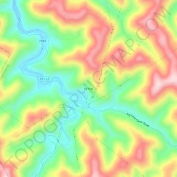
Name: Hi Hat topographic map, elevation, terrain.
Location: Hi Hat, Floyd County, Kentucky, 41636, United States (37.37177 -82.74905 37.41177 -82.70905)
Average elevation: 383 m
Minimum elevation: 228 m
Maximum elevation: 565 m
Thank you for supporting this site ❤️
Make a donation
Make a donation
Other topographic maps
Click on a map to view its topography, its elevation and its terrain.