
Oswaldtwistle topographic map
Click on the map to display elevation.
About this map
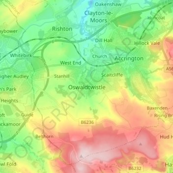
Name: Oswaldtwistle topographic map, elevation, terrain.
Average elevation: 203 m
Minimum elevation: 82 m
Maximum elevation: 377 m
Other topographic maps
Click on a map to view its topography, its elevation and its terrain.
Oswaldtwistle Moor
United Kingdom > England > Lancashire > Hyndburn > Green Haworth > Cocker Brook
Average elevation: 300 m