
Cornville topographic map
Click on the map to display elevation.
About this map
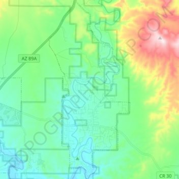
Name: Cornville topographic map, elevation, terrain.
Location: Cornville, Yavapai County, Arizona, 86325, United States (34.68508 -111.93650 34.79391 -111.87597)
Average elevation: 1,129 m
Minimum elevation: 979 m
Maximum elevation: 1,554 m