
Thank you for supporting this site ❤️
Make a donation
Make a donation
Silver Peak topographic map
Click on the map to display elevation.
Thank you for supporting this site ❤️
Make a donation
Make a donation
About this map
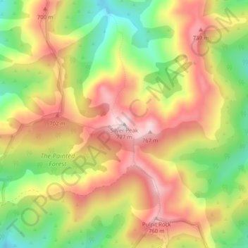
Name: Silver Peak topographic map, elevation, terrain.
Location: Silver Peak, Dunedin City, New Zealand (-45.73547 170.44662 -45.73537 170.44672)
Average elevation: 580 m
Minimum elevation: 373 m
Maximum elevation: 763 m
Thank you for supporting this site ❤️
Make a donation
Make a donation
Other topographic maps
Click on a map to view its topography, its elevation and its terrain.