
Thank you for supporting this site ❤️
Make a donation
Make a donation
Karitāne topographic map
Click on the map to display elevation.
Thank you for supporting this site ❤️
Make a donation
Make a donation
About this map
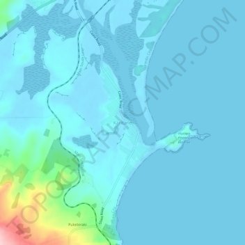
Name: Karitāne topographic map, elevation, terrain.
Location: Karitāne, Dunedin City, Otago, 9510, New Zealand (-45.65804 170.63430 -45.61804 170.67430)
Average elevation: 18 m
Minimum elevation: -1 m
Maximum elevation: 202 m
Thank you for supporting this site ❤️
Make a donation
Make a donation
Other topographic maps
Click on a map to view its topography, its elevation and its terrain.