
Thank you for supporting this site ❤️
Make a donation
Make a donation
Nolin topographic map
Click on the map to display elevation.
Thank you for supporting this site ❤️
Make a donation
Make a donation
About this map
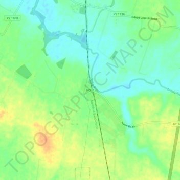
Name: Nolin topographic map, elevation, terrain.
Location: Nolin, Hardin County, Kentucky, 42740, United States (37.54117 -85.92274 37.58117 -85.88274)
Average elevation: 210 m
Minimum elevation: 195 m
Maximum elevation: 231 m
Thank you for supporting this site ❤️
Make a donation
Make a donation
Other topographic maps
Click on a map to view its topography, its elevation and its terrain.