
Thank you for supporting this site ❤️
Make a donation
Make a donation
Pointe au Baril topographic map
Click on the map to display elevation.
Thank you for supporting this site ❤️
Make a donation
Make a donation
About this map
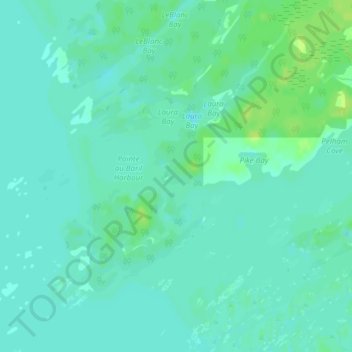
Name: Pointe au Baril topographic map, elevation, terrain.
Average elevation: 177 m
Minimum elevation: 172 m
Maximum elevation: 186 m
Thank you for supporting this site ❤️
Make a donation
Make a donation
Other topographic maps
Click on a map to view its topography, its elevation and its terrain.
Conger Lake
Canada > Ontario > Parry Sound District > The Archipelago Township
Average elevation: 200 m
Skye Island
Canada > Ontario > Parry Sound District > The Archipelago Township
Average elevation: 191 m