
Thank you for supporting this site ❤️
Make a donation
Make a donation
Wallace topographic map
Click on the map to display elevation.
Thank you for supporting this site ❤️
Make a donation
Make a donation
About this map
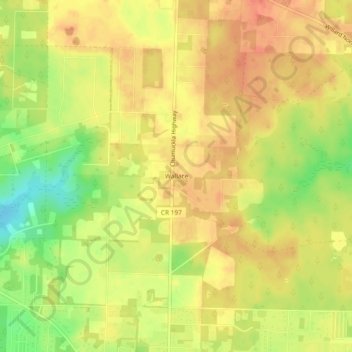
Name: Wallace topographic map, elevation, terrain.
Location: Wallace, Santa Rosa County, Florida, United States (30.65741 -87.19997 30.69741 -87.15997)
Average elevation: 51 m
Minimum elevation: 21 m
Maximum elevation: 67 m
Thank you for supporting this site ❤️
Make a donation
Make a donation
Other topographic maps
Click on a map to view its topography, its elevation and its terrain.