
Thank you for supporting this site ❤️
Make a donation
Make a donation
Booneville topographic map
Click on the map to display elevation.
Thank you for supporting this site ❤️
Make a donation
Make a donation
About this map
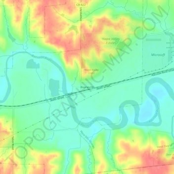
Name: Booneville topographic map, elevation, terrain.
Location: Booneville, Dallas County, Iowa, 50038, United States (41.50416 -93.90384 41.54416 -93.86384)
Average elevation: 272 m
Minimum elevation: 247 m
Maximum elevation: 310 m
Thank you for supporting this site ❤️
Make a donation
Make a donation
Other topographic maps
Click on a map to view its topography, its elevation and its terrain.
Thank you for supporting this site ❤️
Make a donation
Make a donation
Thank you for supporting this site ❤️
Make a donation
Make a donation