
Thank you for supporting this site ❤️
Make a donation
Make a donation
Kertaraharja topographic map
Click on the map to display elevation.
Thank you for supporting this site ❤️
Make a donation
Make a donation
About this map
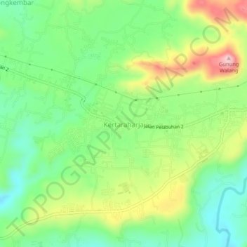
Name: Kertaraharja topographic map, elevation, terrain.
Location: Kertaraharja, Sukabumi, West Java, Java, 43196, Indonesia (-6.99895 106.81364 -6.95895 106.85364)
Average elevation: 380 m
Minimum elevation: 291 m
Maximum elevation: 525 m
Thank you for supporting this site ❤️
Make a donation
Make a donation
Other topographic maps
Click on a map to view its topography, its elevation and its terrain.