
Thank you for supporting this site ❤️
Make a donation
Make a donation
Bhadraj topographic map
Click on the map to display elevation.
Thank you for supporting this site ❤️
Make a donation
Make a donation
About this map
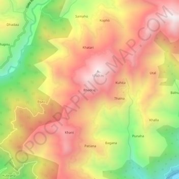
Name: Bhadraj topographic map, elevation, terrain.
Location: Bhadraj, Kalsi, Dehradun, Uttarakhand, India (30.53892 77.85957 30.57892 77.89957)
Average elevation: 1,255 m
Minimum elevation: 557 m
Maximum elevation: 1,792 m
Thank you for supporting this site ❤️
Make a donation
Make a donation