
Thank you for supporting this site ❤️
Make a donation
Make a donation
Bani River topographic map
Click on the map to display elevation.
Thank you for supporting this site ❤️
Make a donation
Make a donation
About this map
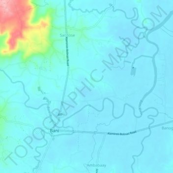
Name: Bani River topographic map, elevation, terrain.
Location: Bani River, Bani, Pangasinan, Ilocos Region, Philippines (16.18487 119.84189 16.20750 119.89191)
Average elevation: 17 m
Minimum elevation: 1 m
Maximum elevation: 135 m
Thank you for supporting this site ❤️
Make a donation
Make a donation