
Thank you for supporting this site ❤️
Make a donation
Make a donation
Bredene-Bad topographic map
Click on the map to display elevation.
Thank you for supporting this site ❤️
Make a donation
Make a donation
About this map
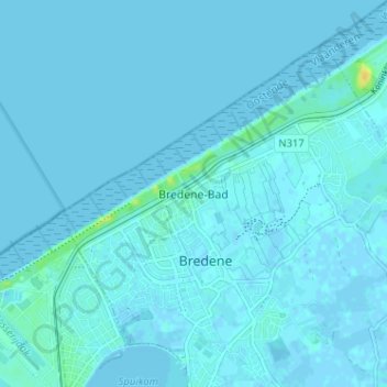
Name: Bredene-Bad topographic map, elevation, terrain.
Location: Bredene-Bad, Bredene, Oostende, West-Vlaanderen, 8450, België (51.22773 2.94279 51.26773 2.98279)
Average elevation: 1 m
Minimum elevation: -2 m
Maximum elevation: 23 m
Thank you for supporting this site ❤️
Make a donation
Make a donation
Other topographic maps
Click on a map to view its topography, its elevation and its terrain.