
Manitou topographic map
Interactive map
Click on the map to display elevation.
About this map
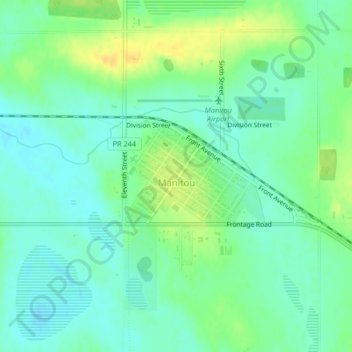
Name: Manitou topographic map, elevation, terrain.
Location: Manitou, Pembina, Manitoba, R0G 1G0, Canada (49.23295 -98.54522 49.24782 -98.52225)
Average elevation: 487 m
Minimum elevation: 477 m
Maximum elevation: 501 m