
Concho topographic map
Click on the map to display elevation.
About this map
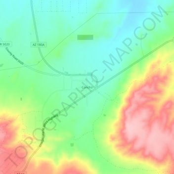
Name: Concho topographic map, elevation, terrain.
Location: Concho, Apache County, Arizona, 85914, United States (34.45531 -109.62594 34.49531 -109.58594)
Average elevation: 1,844 m
Minimum elevation: 1,780 m
Maximum elevation: 1,942 m