
Thank you for supporting this site ❤️
Make a donation
Make a donation
El Refugio topographic map
Click on the map to display elevation.
Thank you for supporting this site ❤️
Make a donation
Make a donation
About this map
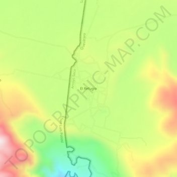
Name: El Refugio topographic map, elevation, terrain.
Location: El Refugio, Arroyo Seco, Querétaro, Mexico (21.53276 -99.76688 21.57276 -99.72688)
Average elevation: 1,035 m
Minimum elevation: 758 m
Maximum elevation: 1,339 m
Thank you for supporting this site ❤️
Make a donation
Make a donation