
Mora topographic map
Interactive map
Click on the map to display elevation.
About this map
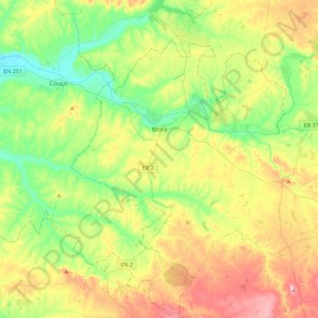
Name: Mora topographic map, elevation, terrain.
Location: Mora, Évora, Portugal (38.80497 -8.27219 39.02693 -7.88979)
Average elevation: 129 m
Minimum elevation: 23 m
Maximum elevation: 309 m
Other topographic maps
Click on a map to view its topography, its elevation and its terrain.