
Chamula topographic map
Interactive map
Click on the map to display elevation.
About this map
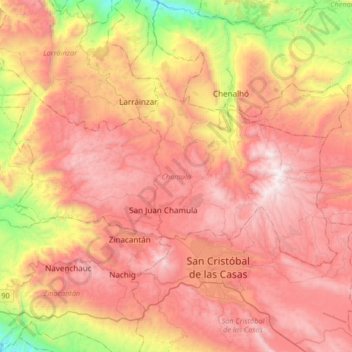
Name: Chamula topographic map, elevation, terrain.
Location: Chamula, Chiapas, México (16.73619 -92.85646 16.89786 -92.52684)
Average elevation: 2,025 m
Minimum elevation: 872 m
Maximum elevation: 2,881 m
Other topographic maps
Click on a map to view its topography, its elevation and its terrain.