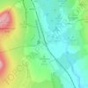
Thrintoft topographic map
Click on the map to display elevation.
About this map

Name: Thrintoft topographic map, elevation, terrain.
Location: Thrintoft, North Yorkshire, England, United Kingdom (54.32683 -1.53064 54.35926 -1.49288)
Average elevation: 38 m
Minimum elevation: 25 m
Maximum elevation: 62 m
Other topographic maps
Click on a map to view its topography, its elevation and its terrain.


















Bolton Castle
United Kingdom > England > North Yorkshire > Redmire > Castle Bolton
Average elevation: 250 m


Thimbleby & Osmotherly Show field
United Kingdom > England > North Yorkshire > Thimbleby
Average elevation: 152 m






Killinghall
United Kingdom > England > North Yorkshire > Harrogate > Killinghall
Average elevation: 86 m



Ribblesdale
United Kingdom > England > North Yorkshire > Horton in Ribblesdale
Average elevation: 368 m