
Thank you for supporting this site ❤️
Make a donation
Make a donation
Hoy topographic map
Click on the map to display elevation.
Thank you for supporting this site ❤️
Make a donation
Make a donation
About this map
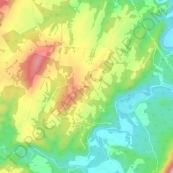
Name: Hoy topographic map, elevation, terrain.
Location: Hoy, Hampshire County, West Virginia, United States (39.29788 -78.57196 39.33788 -78.53196)
Average elevation: 330 m
Minimum elevation: 242 m
Maximum elevation: 454 m
Thank you for supporting this site ❤️
Make a donation
Make a donation
Other topographic maps
Click on a map to view its topography, its elevation and its terrain.