
Thank you for supporting this site ❤️
Make a donation
Make a donation
Goshen topographic map
Click on the map to display elevation.
Thank you for supporting this site ❤️
Make a donation
Make a donation
About this map
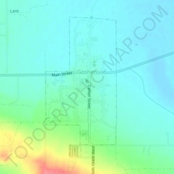
Name: Goshen topographic map, elevation, terrain.
Location: Goshen, Utah County, Utah, 84633, United States (39.93980 -111.90917 39.96152 -111.89480)
Average elevation: 1,393 m
Minimum elevation: 1,377 m
Maximum elevation: 1,447 m
Thank you for supporting this site ❤️
Make a donation
Make a donation
Other topographic maps
Click on a map to view its topography, its elevation and its terrain.
Thank you for supporting this site ❤️
Make a donation
Make a donation
Thank you for supporting this site ❤️
Make a donation
Make a donation
Saratoga Springs Park
United States > Utah > Utah County > Saratoga Springs > Saratoga Resort
Average elevation: 1,375 m