
Thank you for supporting this site ❤️
Make a donation
Make a donation
Forks topographic map
Click on the map to display elevation.
Thank you for supporting this site ❤️
Make a donation
Make a donation
About this map
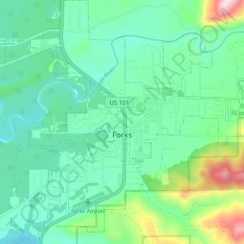
Name: Forks topographic map, elevation, terrain.
Location: Forks, Clallam County, Washington, United States (47.92930 -124.41973 47.97613 -124.35219)
Average elevation: 113 m
Minimum elevation: 40 m
Maximum elevation: 343 m
Thank you for supporting this site ❤️
Make a donation
Make a donation
Other topographic maps
Click on a map to view its topography, its elevation and its terrain.
Thank you for supporting this site ❤️
Make a donation
Make a donation
Thank you for supporting this site ❤️
Make a donation
Make a donation