
Thank you for supporting this site ❤️
Make a donation
Make a donation
Taheri Rural District topographic map
Click on the map to display elevation.
Thank you for supporting this site ❤️
Make a donation
Make a donation
About this map
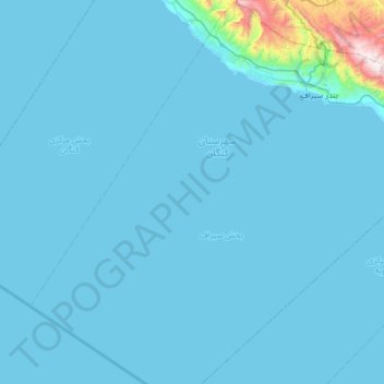
Name: Taheri Rural District topographic map, elevation, terrain.
Average elevation: 62 m
Minimum elevation: -1 m
Maximum elevation: 1,540 m
Thank you for supporting this site ❤️
Make a donation
Make a donation
Other topographic maps
Click on a map to view its topography, its elevation and its terrain.
Kangan Seaport
Iran > Bushehr Province > Kangan County > دهستان حومه کنگان > Kangan Seaport
Average elevation: 84 m